Thank you for visiting SNEWPapers!
Sign up free
Story
August 19, 1949
The East Hartford Gazette
New Britain, Hartford County, Connecticut
What is this article about?
U.S. Air Force 72nd Photo Reconnaissance Squadron photographs Mt. McKinley and 260,000+ square miles of Alaska using B-29s since 1946 for mapping charts; shows crew loading cameras.
Clipping
OCR Quality
98%
Excellent
Full Text
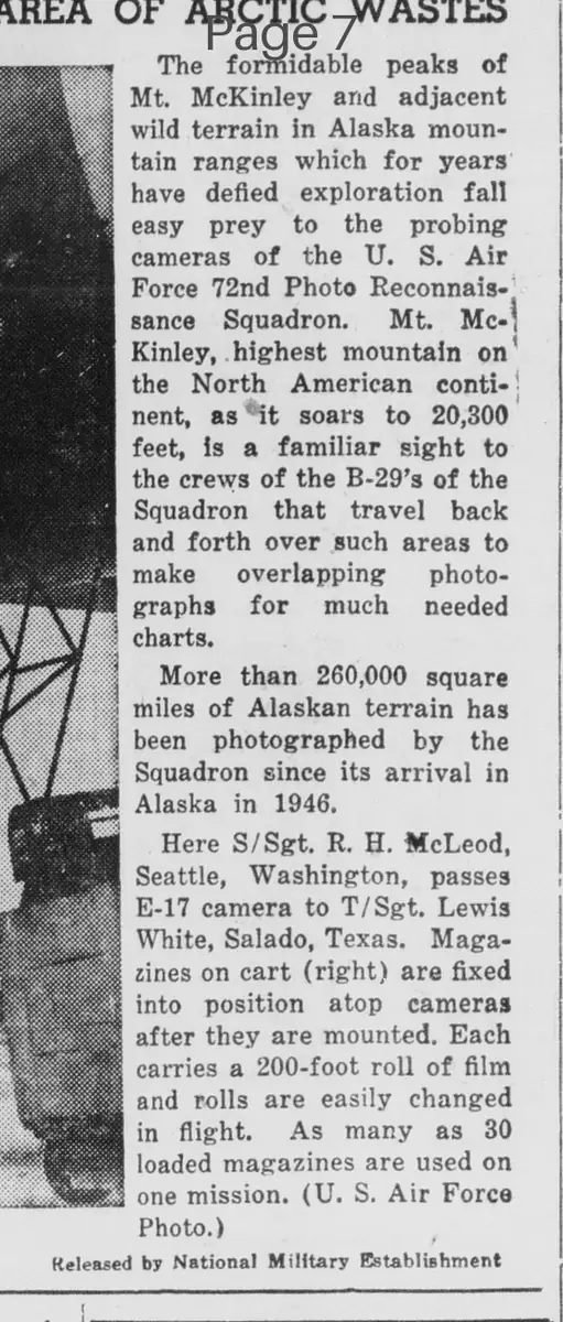
The formidable peaks of Mt. McKinley and adjacent wild terrain in Alaska mountain ranges which for years have defied exploration fall easy prey to the probing cameras of the U. S. Air Force 72nd Photo Reconnaissance Squadron.
Mt. McKinley, highest mountain on the North American continent, as it soars to 20,300 feet, is a familiar sight to the crews of the B-29's of the Squadron that travel back and forth over such areas to make overlapping photographs for much needed charts.
More than 260,000 square miles of Alaskan terrain has been photographed by the Squadron since its arrival in Alaska in 1946.
Here S/Sgt. R. H. McLeod, Seattle, Washington, passes E-17 camera to T/Sgt. Lewis White, Salado, Texas. Magazines on cart (right) are fixed into position atop cameras after they are mounted. Each carries a 200-foot roll of film and rolls are easily changed in flight.
As many as 30 loaded magazines are used on one mission. (U. S. Air Force Photo.)
Released by National Military Establishment
What sub-type of article is it?
Historical Event
Adventure
What themes does it cover?
Exploration
Triumph
What keywords are associated?
Aerial Photography
Alaska Terrain
Mt Mckinley
Us Air Force Squadron
Photo Reconnaissance
What entities or persons were involved?
S/Sgt. R. H. Mcleod
T/Sgt. Lewis White
Where did it happen?
Alaska Mountain Ranges, Mt. Mckinley
Story Details
Key Persons
S/Sgt. R. H. Mcleod
T/Sgt. Lewis White
Location
Alaska Mountain Ranges, Mt. Mckinley
Event Date
Since 1946
Story Details
The U.S. Air Force 72nd Photo Reconnaissance Squadron uses B-29 aircraft to photograph Mt. McKinley and over 260,000 square miles of Alaskan terrain for charts, with crew members handling E-17 cameras and magazines in flight.