Thank you for visiting SNEWPapers!
Sign up free
Montana Oil And Mining Journal
Great Falls, Billings, Cascade County, Yellowstone County, Montana
What is this article about?
Dr. Charles Deiss of Montana State University is appointed assistant geologist by USGS to lead long-term mapping of northern Montana's geology, building on his 1930 studies of Cambrian rocks and trilobites, with 1940 fieldwork in Sun River area accompanied by assistants.
Clipping
OCR Quality
Full Text
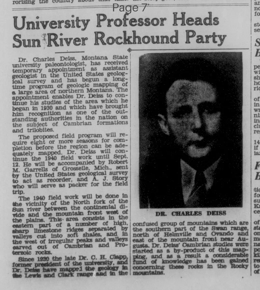
Dr. Charles Deiss, Montana State university, paleontologist, has received temporary appointment as assistant geologist in the United States geological survey and has begun a long-time program of geologic mapping of a large area of northern Montana. The appointment enables Dr. Deiss to continue his studies of the area which he began in 1930 and which have brought him recognition as one of the outstanding authorities in the nation on the subject of Cambrian formations and trilobites.
DR. CHARLES DEISS
The proposed field program will require eight or more seasons for completion before the region can be adequately mapped. Dr. Deiss will continue the 1940 field work until Sept. 12. He will be accompanied by Robert M. Garrells of Grosseile, Mich., sent by the United States geological survey to act as recorder, and A. J. Story who will serve as packer for the field trip.
The 1940 field work will be done in the vicinity of the North fork of the Sun river between the continental divide and the mountain front west of the plains. This area consists in the eastern part of a number of high, sharp limestone ridges separated by valleys cut into soft shales, and in the west of irregular peaks and valleys carved out of Cambrian and Proterozoic rocks.
Since 1920 the late Dr. C. H. Clapp, former president of the university, and Dr. Deiss have mapped the geology in the Lewis and Clark range and in the confused group of mountains which are the southern part of the Swan range, north of Helmville and Ovando and east of the mountain front near Augusta. Dr. Deiss' Cambrian studies were started as a by-product of this mapping, and as a result a considerable fund of knowledge has been gained concerning these rocks in the Rocky mountains.
What sub-type of article is it?
What themes does it cover?
What keywords are associated?
What entities or persons were involved?
Where did it happen?
Story Details
Key Persons
Location
Northern Montana, Vicinity Of The North Fork Of The Sun River, Lewis And Clark Range, Swan Range, Near Helmville, Ovando, And Augusta
Event Date
1940
Story Details
Dr. Charles Deiss, paleontologist at Montana State University, appointed assistant geologist for USGS to map northern Montana's geology, focusing on Cambrian formations and trilobites, continuing work begun in 1930 with prior mapping since 1920.